 |
| What's New | Links | FAQ | Contact |

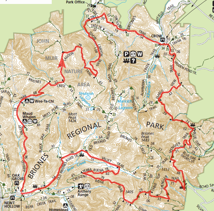
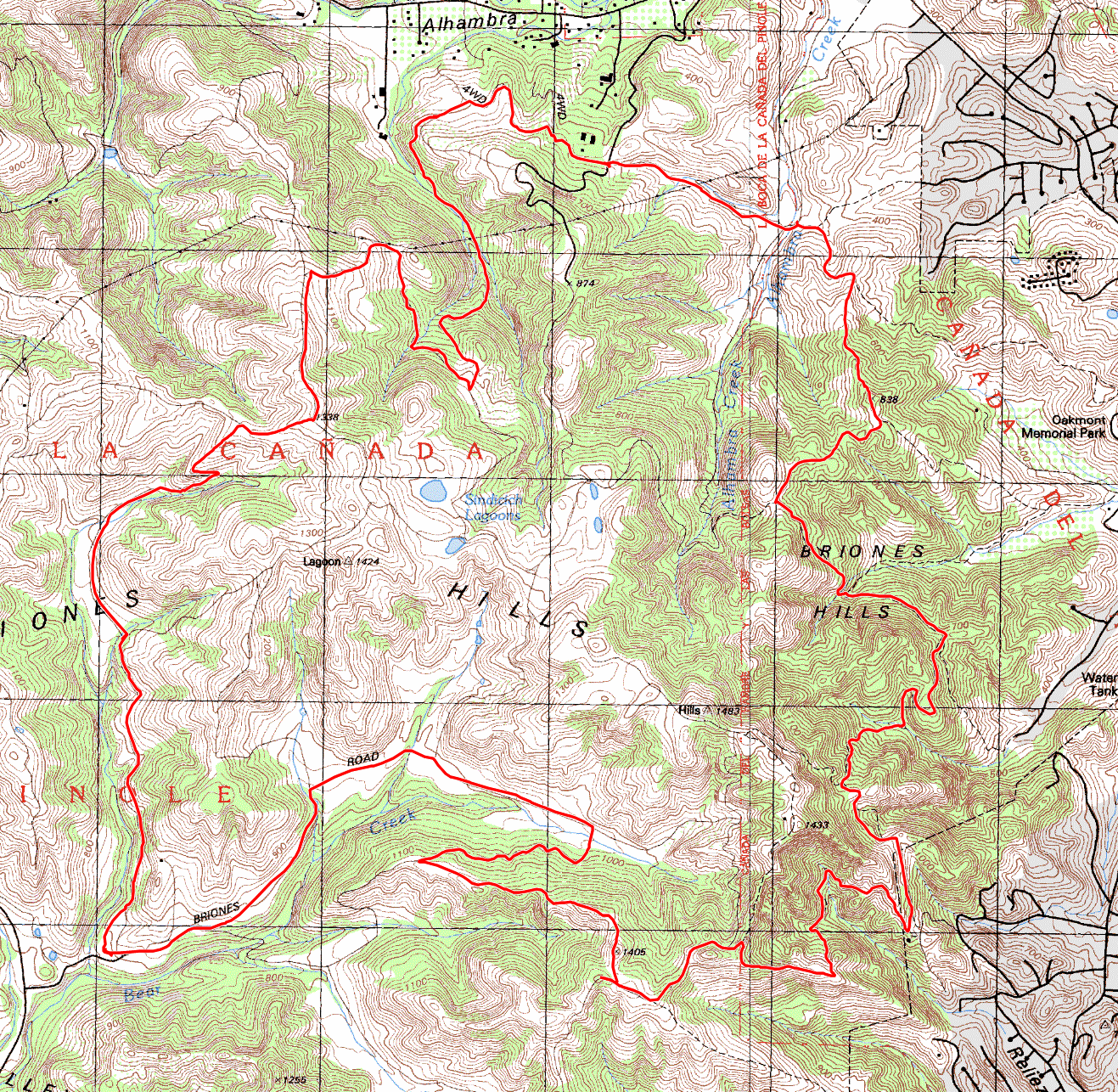
GPS Track Suggested Parking Park Map: Highlighted Original (PDF) Topographic Map Park Website Photos |
Briones (Suggestion 2) 100% FIRE ROAD 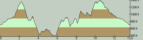
THE PARKBriones Regional Park is a decent sized open space area not far from Walnut Creek. It contains many miles of trails, the vast majority of which are fire roads. For the most part, only the fire roads in the park are legal for bikes. Other than a few tiny stretches of pseudo-singletrack created here and there due to fire roads being narrowed by vegetation, the only bike-legal trail segments I can point out with any level of confidence as singletrack at Briones are Blue Oak Trail, which I haven't tried, and a half-mile segment of Briones Crest Trail. As with most fire roads in the East Bay, the climbs in this park can be very steep, usually for no apparent good reason. I often attribute this to the fact that most of these fire roads must have been old ranch roads built based more on practical need than any kind of concern for maintaining a judicious grade. Despite the steepness of the trails here, you won't find any long climbs at Briones. Most serious climbs peter out in less than two miles. Then again, a few of the ultra-short slopes can be so steep that they'll make you shake your head in wonder. Like most East Bay rides, this area would be most enjoyable during the season when the grass is green (roughly between January and April). That time of year, this whole region looks like one giant lawn. Even when done against a backdrop of hay-colored hills, though, rides at Briones can be pretty scenic. The landscape is pretty, with a picturesque mix of cute valleys, rolling hills, and a combination of grassland and wooded patches that almost seems to have been painstakingly arranged purely for variety. From many ridgetops, you also catch views stretching across Suisun Bay toward the Delta or into the upper reaches of San Ramon Valley and to Mount Diablo. Parking inside the park is subject to a fee. This fee is $3 as of the last time I've ridden here. There is a toll booth as you enter the parking lot, where an attendant is present. I'm not aware of any self-pay method for the times when the attendant isn't there. Use of the parking lot appears to be free when the booth is not attended, as far as I know. Those of you who'd rather evade the parking fee may want to know that there is a moderate amount of roadside parking available on Bear Creek Road immediately adjacent to the entrance of the park's very short driveway, and that parking there seems to be tolerated. (But, don't attempt to invoice me if you get ticketed or towed!) THE RIDEThis route is simply a longer ride option at Briones than my first one and isn't very special in any way other than that. I won't pretend that I've ridden at Briones enough times to make this ride a particularly recommended one in contrast to many other possibilities here of similar length. This is merely my attempt at putting together a more substantial ride at Briones that includes a few of the more desirable trails here (such as Lagoon Trail and Crescent Ridge Trail) while trying to avoid as many of the bad climbs as I can. So, feel free to vary it to your liking and to improvize; the possibilities at Briones are hard to exhaust. This ride starts out much more gently than the first Briones ride suggestion on this website. For the first mile-and-a-half of the ride, Abrigo Valley Trail ambles up at a considerably lazy grade. What follows that is half a mile during which you gain more elevation than you did up to that point. On the ridgetop at the end of this first major climb, views open up around you in many directions and you start a very scenic descent on Lagoon Trail; although the trail itself is nothing special, just a steep fire road. Soon after that, the route descends to skirt by the trailheads and picnic areas along the northern boundary of the park. This is followed by the next major chunk of climbing on the ride, and this is a more broken-up elevation gain where ascents and descents are intermingled. A couple of ridiculously steep uphill stretches of the ride (north of 30% grade) also arrive around this time, on Spengler Trail. The climbs never really cease until you reach the last three miles of the ride, which constitutes an unbroken descent. Near the end of the ride, the route turns from Crescent Ridge Trail onto Yerba Buena Trail to reach Valley Trail. The portion of the route after Yerba Buena Trail is just a flat meander that's initially across a flat-bottomed, cattle-grazing valley and then along a smooth gravel road (though the valley is a pretty one). A slightly more interesting option from a biking point of view might be to stay on Crescent Ridge Trail to get to Seaborg Trail and to follow that one back to the parking lot instead, even though this option is nothing more than a fire-road descent either. © Ergin Guney
Comments: blog comments powered by Disqus |