 |
| What's New | Links | FAQ | Contact |

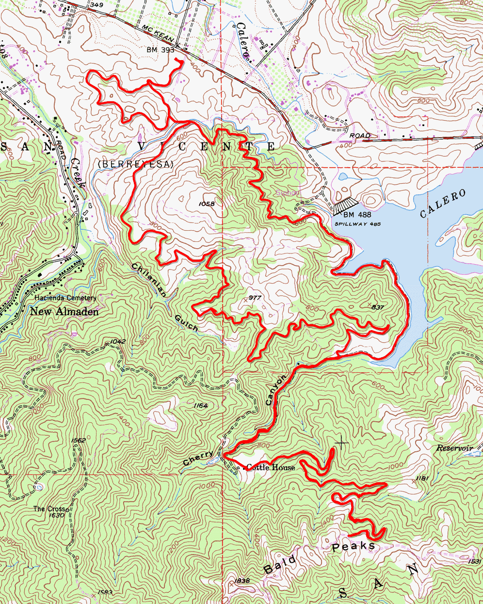
GPS Track Park Map: Highlighted Original (PDF) Topographic Map Photos |
Calero County Park (Alternate route) 71% SINGLETRACK28% FIRE ROAD1% ROAD 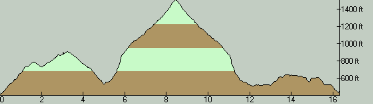
This is an extended version of the main Calero County Park ride on this site. On this page, I will only describe the out-and-back side trip that follows Cottle Trail onto Chisnantuk Peak Trail, which is the only part added to the basic loop. For the description of the rest of the ride, please refer to the main Calero County Park entry. This version of the ride adds a seven-mile out-and-back trip to the original route that will also increase your total climb by 1000 feet. This side trip begins by continuing on Cottle Trail past the southernmost point of the ride's main loop. For nearly a mile into this extension, Cottle Trail closely follows the creek bed in Cherry Canyon in the form of a fire road. The bad news is that the ride's steepest segment arrives in this stretch and the slopes are almost an order of magnitude worse than what you encounter over the rest of the ride. The worst of it is a 0.3-mile stretch on this climb where the grade averages 13.5%. There even appears to be a 100-yard or so segment where the grade appears to average above 18%. The good news is that, once you reach the Cottle Rest Site (historically the site of a Cottle House, apparently), thereby completing this hike-a-bike stretch, you find yourself on a recently constructed narrow trail that does the rest of the climb at a much saner grade, which is Chisnantuk Peak Trail. This trail is of "multi-use" width, which I categorize as singletrack, especially because there are some portions of it that do look a lot more like a nice and narrow, hillside singletrack. You stay on this nice trail for a touch over 2.5 miles as it leisurely switchbacks up the hill. The overall average grade of your mileage on Chisnantuk Peak Trail is only about 4.5%, though it's not all that even. The grade actually reaches 8% a number of times (and maybe even touches 10% once or twice) but it never sustains that for any appreciable distance. While this non-technical climb on Chisnantuk Peak Trail is pleasant and moderately sloped, if you notice its additional elevation gain and hope that this will mean much better views will be available to you, you might be a little disappointed. Yes, there are a few spots in this part of the ride that present nice and wide views, but this only happens in a handful of spots. So, the main reward for the climb is really just the returning descent that follows the same trail back down. This is not a descent that hard-core mountain bikers will salivate over, but it's a nice-enough, winding descent for 2.5 miles that's fairly fun. You can also include the much steeper and rougher descent of Cottle Trail to that math and think of it as a 3.5-mile descent that's essentially unbroken. Despite the name of Chisnantuk Peak Trail, it doesn't appear to terminate at or pass over any identifiable peak and I can't spot any location labeled "Chisnantuk Peak" in this vicinity on the USGS topographic maps. This extension of the ride simply turns back from the trail's junction with Bald Peaks Trail in Rancho Cañada del Oro. This, of course, gives you more extension options within the trail network of that latter park, though any extra mileage you can add there will have to be accompanied by significant additional elevation gain. |