 |
| What's New | Links | FAQ | Contact |

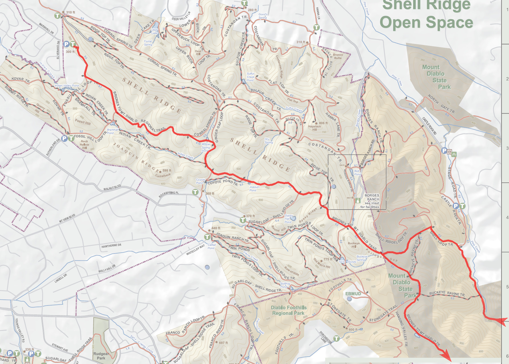
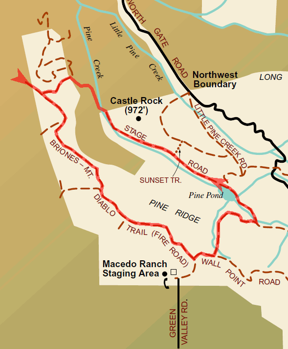
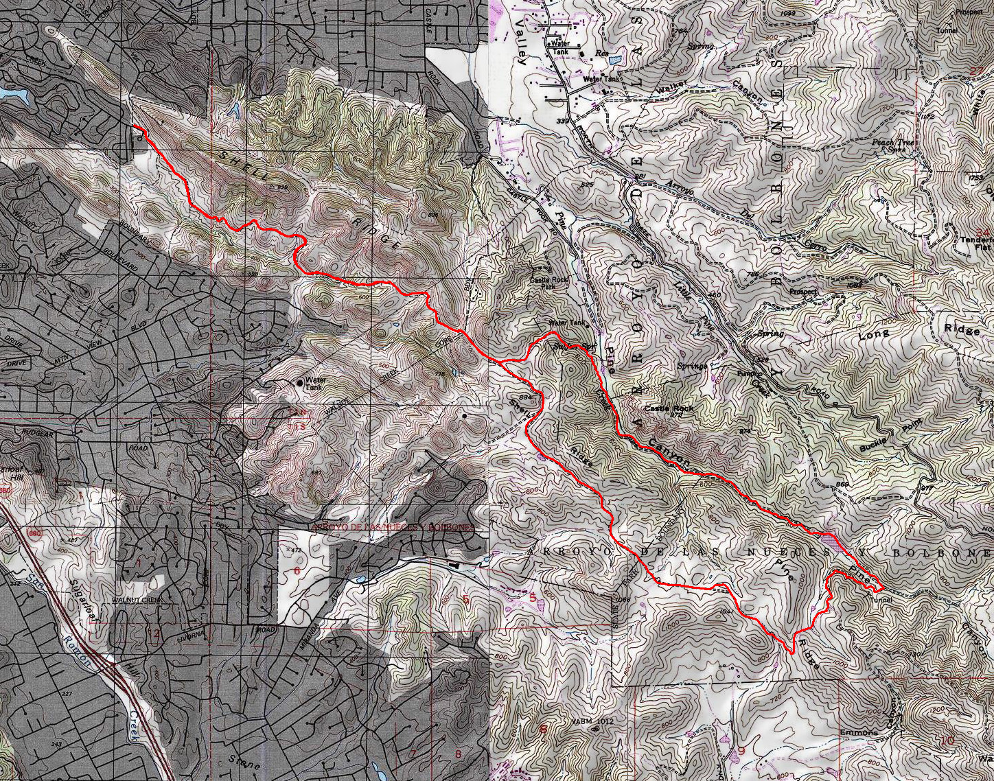
GPS Track Park Maps: Highlighted: Shell Ridge Mount Diablo Original: Shell Ridge (PDF) Mount Diablo (PDF) Topographic Map Photos |
Mount Diablo (Walnut Creek to South Gate Road) (Alternate route) 99% FIRE ROAD1% ROAD 
This is the (much) shorter version of the full "Mount Diablo (Walnut Creek to South Gate Road)" ride. To do this version of the ride, simply turn left at the junction of Wall Point Road and Dusty Road rather than turning right as implied in the original ride. With the exception of the short descent on Dusty Road, all of the mileage of this route is part of the full ride. I will, therefore, not repeat the description of those trails on this page. Please refer to the text of the full ride for the description of the trail segments that overlap with this shortened version. One additional note is still in order here: If you use the photo set of this version of the ride, please keep in mind that I did it early in a spring that followed an unusually wet winter. You will, therefore, see the photos showing a particular segment of Briones to Mount Diablo Regional Trail in virtually its worst possible state of cow damage and mud. Please know that, while some amount of seasonal damage commonly occurs every winter on this trail, the state shown in this photo set is an uncommonly bad case. Refer to the photo set of the full ride to see the normal state of that same trail segment that you're much more likely to encounter if you do this ride. © Ergin Guney
Comments: blog comments powered by Disqus |